Paso Roballos Border
After a quick clearing out process at the remote Paso Roballos border in Argentina – and receiving a rare exit stamp – entering Chile was supposed to be easy. Fast. Straightforward. Uneventful. Well…
First, about twenty people were waiting to clear out of Chile, filling out forms and not having applied for the right paperwork online. Mark and I were the only ones entering, but we couldn’t cut the line in front of the one window. So, we waited for over an hour.
(As always, click on or hover over photos in galleries to read their captions.)


When we finally approached the booth, the officials seemed to be surprised we were actually arriving in Chile. I guess they hadn’t seen our giant cow-like camper through the window, on the Argentinian side?
Since this is a police-manned post instead of the usual offices of immigration, customs, and agriculture, reports of 5-minute crossings abound. What we found, however, was a team of unhelpful and inefficient cops. Our paperwork was in order, yet, we were told to wait in our car until “Interpol confirmed our identities.” How long would that take? What about them keeping our passports and original car title? Oh, and it was raining as well.
After another hour of sitting in the cab of our truck, one of the uniformed men opened the gate and motioned us to drive forward. He handed us back our important, now water-stained documents. Because it was after 5pm already and too late to make it to our next destination of Cochrane, we spent the night by a historic building in Patagonia National Park.
At 1am, when the relentless wind shook the camper violently, preventing us from sleeping, we moved behind the protection of trees. Our neighbors did the same.


Patagonia National Park
Usually, dogs are not allowed in national parks and there are steep entrance fees, but because pretty Patagonia NP envelops the bouncy dirt road to the border, anyone can drive through. So, that’s what we did. We kept Maya in the car and skipped the trails. Instead, we observed this special and somewhat spiritual park through our car windows.


We stopped by the visitor center to pay our respects at the grave of Douglas Tompkins, an American philanthropist and conservationist, who was responsible for founding this park and preserving millions of acres of land in Chile and Argentina.


Cochrane
We reached the Carretera Austral outside of Patagonia NP and turned south. It was in rough shape and we soon learned that the highlights of this region involved detours from the Carretera – also called Ruta 7 – on even worse roads. We mentally prepared for rattling sensations, potential camper issues, and retightening screws every few days.


Our first stop was in Cochrane, since our car needed an urgent wash and we had to fix a couple of things on Bella. For this, we required a campground. We couldn’t reach the first one because of low-hanging tree branches. The second one had a nasty, steep ditch and was too expensive anyway. The third one was the charm, kind of. After some pleading, the owner allowed us to quickly clean our car and get settled in the back. We managed to take our camper off, but things got more difficult when the place filled up and our unopened tube of caulk had gone bad, so we needed to find something locally.


We managed to finish our urgent projects before checkout time at noon the following day, stocked up on food (Chile is strict with the importation of fresh products), waited in line to fill up with gasoline, and moved to a river location to sit out two days of rain, wind, and cold.


Our propane had to last for another month, so we refrained from turning our heater on and wore winter clothes inside the camper, hiding under the covers when needed. Mark worked and I applied for a new job, dealing with tests and certifications. Maya kept us awake at night, when tree particles fell on our roof due to wind gusts.


Tortel
We had decided to make a detour south to the fishing village of Tortel. After four hours of driving to cover the 70 miles (105km), we found the parking lots and street sides above this pedestrian-only town packed to the brim! Talk about a disappointment. After all this effort, and it was a rare sunny day, we couldn’t park anywhere, let alone visit Tortel.


Instead of waiting around, being a big nuisance (literally) to other traffic, and becoming even more frustrated, I suggested we’d set up camp and call it a day. Luckily, after some trial and error, we found a great spot along the Rio Baker, one of the prettiest rivers in the world.


We started early the next day, arriving at Caleta Tortel before 9am. Mark and Maya approached this tourist attraction by walking up and over a hill, while I descended the stairs to reach the main part of the village. While relatively cute – the concept of getting around via wooden stairs and boardwalks is unique – most buildings look run down and fishing is not part of the culture anymore.


I met my companions by the beach after an hour of solo strolling, to then return the same way with them. Many loose dogs hung around the boardwalks, but no incidents happened with Maya. We looked forward to finally eating out, but had to wait until 1pm, since nothing was open before that.


Would we recommend a visit to Tortel? On a sunny day, it would certainly be more picturesque. We don’t regret making the detour, but are not sure it was worth beating our vehicle and ourselves up for eight hours on the bumpy gravel road there and back.


Rio Baker
We woke up to sunshine! On a day like that, “everything” has to happen – driving (which also means running errands since we are underway), sightseeing, taking Maya for a walk, and working, since the sun provides power for our computers.


The four hours of bouncy driving back to Cochrane opened up beautiful vistas, so we stopped a few times to appreciate and photograph them. We bought more food in town and moved to another pretty camping spot by the Baker River, to lift our camper for a checkup and call my parents, something I manage to do every week.


Unfortunately, we could only stay one night, because these two days of sun would run out fast and we had looked forward to a highlight along this route, the Marble Caves in Puerto Rio Tranquilo.
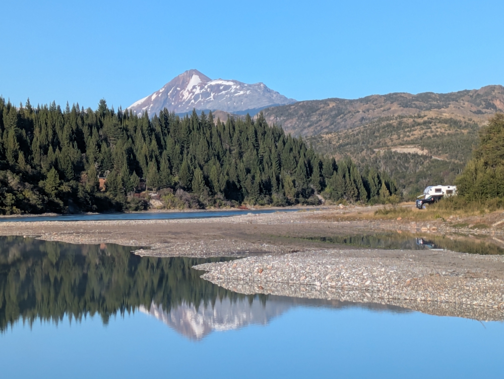
Our picturesque location along the Baker River
Puerto Rio Tranquilo
Our second sunny day was also packed! We stopped along the Carretera Austral to go for a few short walks and take in extraordinary vistas.


And we drove on what must be one of the roughest and slowest stretches of this road. It took three hours to cover the 50 miles (75km) to Puerto Rio Tranquilo, which was buzzing with activity and had tons of campers parked along the shores of stunning General Carrera Lake, the place where Douglas Tompkins died in a kayaking accident.


While we knew the Marble Caves are best visited on a sunny morning, we hadn’t arrived here in time for that and the next day would be cloudy. So, we booked the longer 2.5-hour boat tour for 4:30pm (it remained light until 8:30pm in mid-February) on this bright and sunny afternoon, thinking the lighting would be better than on a cloudy morning. Maya was welcome to join us.
Except, when we were finally allowed to board by 5pm (another half an hour of good light gone), the captain refused to take our dog and Mark had to bring her back to our camper and get her settled, before the tour could finally start. Of course, by the time we reached the caves, the lighting was less than ideal.


The sights of the marble caves and the bright-blue lake were still stunning, but we didn’t mind that the tour was cut half an hour short, so we could join Maya again, go out for a delicious pizza dinner, and search for a decent camp spot.


Rio Murta
After buying more produce, running into Argentinian friends we made a couple of years ago in Ecuador, and braving the bumpy Carretera for another couple of hours, we settled by another pretty river for a few days.
When Yvana and Marcelo knew we were in Rio Tranquilo and they happened to pass through, they looked for us and found our easily spotted cow parked in town.
Mark had to deal with a pesky insurance issue for his mom (which took tons of hours, is still hanging over his head, and hasn’t been resolved six weeks later), we washed clothes in the icy river water, fought constant condensation and mold in our camper, worked, and caught up on other online and offline commitments.


Each time we had (Argentinian) neighbors, the peace was disturbed and each time we took Maya for a walk, we encountered toilet paper and human waste (which could turn into a snack for our dog). Where was the fun in any of this?
Mark and I started to have conversations about how we could improve our lifestyle and happiness, because the dusty Carretera Austral – which we assumed would be our highlight in Patagonia and the part we’d commit most time to – was not providing that, despite the spectacular lakes and rivers.


Cerro Castillo
At an average of 10mph (15km/h), we covered the next 40-mile leg of the Carretera Austral to Villa Cerra Castillo, stopping a few times along the way to take in the (cloudy) views. We decided to camp by a historic site and visit it the next morning.


Las Manos is less impressive than a similar, yet prohibitively expensive, site near the border in Argentina, but it gave us a good idea about the art of hand painting on rocks, thousands of years ago. Maya could join us for this walk, so we had a good start to the day, despite barking dogs keeping us awake at night.


Lago La Paloma
Near Cerro Castillo, the Carretera Austral had turned into pavement! We were happy and relieved. So why did we decide to take an awful, gravel detour to see three lakes? We rely too much on outdated or inaccurate comments in iOverlander, I think.


We did pass the three attractive lakes, and a sweet little waterfall, but our stay in this supposedly amazing location next to Lake La Paloma was troubled by wind, rain, more administrative issues requiring calls and research, and work. Our moods kept deteriorating.


Puente Piedra
We had Puente Piedra to look forward to. Mark had pinned this beautiful location on Google Maps years ago. The issue? It was another remote spot requiring access via potholed gravel roads and direct sun to make this site shine.


Before that moment, we did a grocery stock-up in Coyhaique – the biggest city along Ruta 7, with great stores – and hid inside our camper for days, dealing with non-stop rain, wind, condensation (one night, drops on my face startled me), online issues, research, work, and discomfort. We hoped this site would be worth all the effort and waiting.


One morning, the sun popped out. Together with our Swiss neighbors, Marc and Vale, we hiked to the small river canyon of Puente Piedra and it was perfect! We were the only ones present and at noon, the sun was in the ideal spot to reflect the colors of the river and swimming hole. This optimal light lasted half an hour.


Bravely, three of us jumped into the sparkling pool, which was deceptively cold. As a matter of fact, this water was by far the coldest I have ever encountered! We estimate it was around 4˚C (39˚F). Never before did I feel needle pricks and numb feet, not even in Antarctica. An interesting sensation!


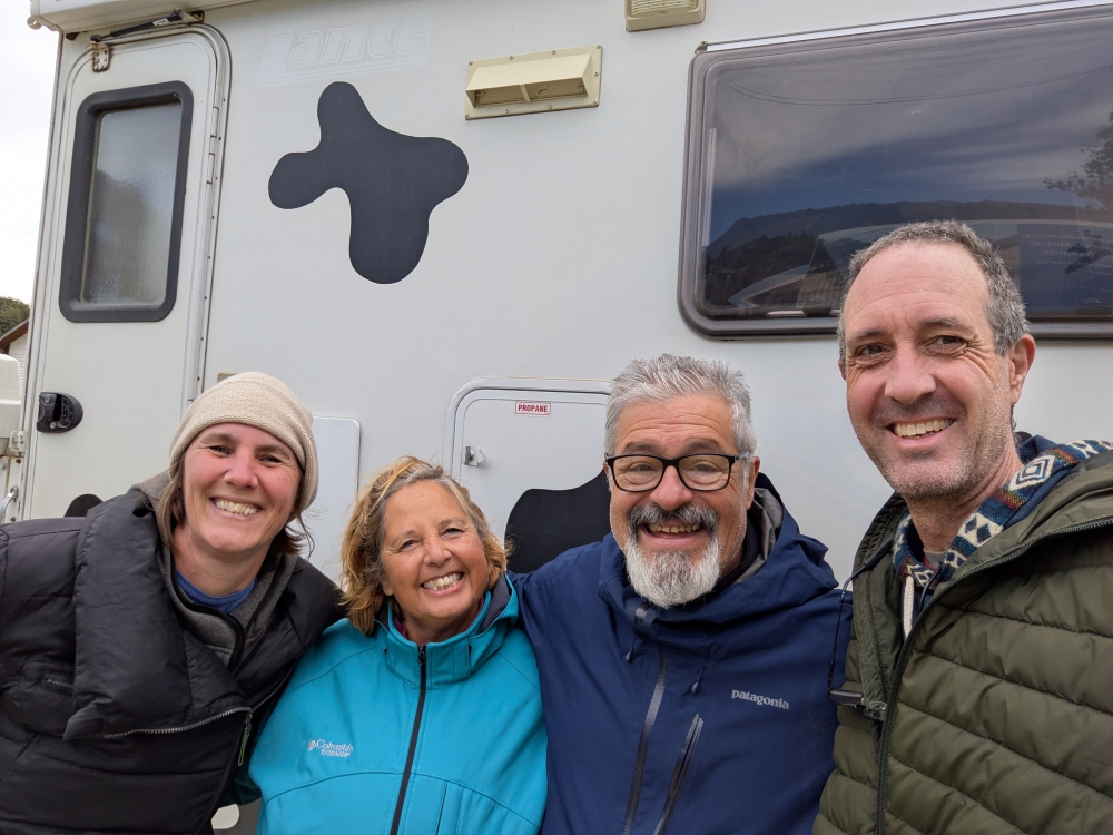
En route to our next camp spot for the night, we passed an American truck camper coming from the opposite direction, flashing its lights. The couple inside frantically waved and in a fraction of a second, the vehicle made a U-turn. We figured we’d better stop to see what this was all about. And that’s how we met Mo and Christophe, who have been following our Facebook page for many years. We exchanged tips and information and continued our separate ways.


Puerto Raúl Marin Balmaceda (RMB)
Friends and iOverlander commenters had recommended RMB as a peaceful fjord destination along Chile’s coast to watch dolphins and relax. It seemed like the perfect place to celebrate Mark’s birthday on March 1st, so we decided to make this detour after a stop in the small town of La Junta, where, surprisingly, a monument dedicated to dictator Augusto Pinochet is located. He is responsible for the existence of the Carretera Austral.


RMB was another substantial detour from our northern progress along the Carretera with a surprise ferry that doesn’t run during a three-hour lunch break. Luckily, the dirt road was in good shape and we found a decent spot to camp. That first evening, we did enjoy watching dolphins swim by, yet the sound of someone pressure washing the dock next to us until 9pm disturbed the peace.


The sunny weather forecast was wrong, so we only lasted one more night and day, on which we took Maya for a beach walk in the dreary weather. We left RMB prematurely on Mark’s birthday and drove all the way to Futaleufú, for a major highlight in South America: rafting on the notorious river of the same name.


It was a long day with a ferry ride, a funny breathalyzer test in La Junta, a stop by the museum of Villa Santa Lucia that was once demolished by a mudflow in 2017, and hours of driving, first on pavement, then on the really poor sideroad to Futaleufú, which gave us a first glimpse of the river.


Futaleufú
Called Futa by the locals, this town is quite cute and relaxed. It’s near the border with Argentina. Mark and I hoped to cross over again, in search for better weather, better roads, cheaper fuel, and necessary propane gas. But, since we didn’t consider this earlier, we didn’t have the right paperwork for Maya to enter another country, which is only obtainable in bigger cities. Despite none of our current resources mentioning a vet or agricultural department in this small town, we kept our fingers crossed for a positive outcome. We really didn’t want to repeat that crappy, two-hour stretch back to the Carretera Austral.


The weather had turned sunny by the time we settled by the lake of Futaleufú, so we could toast to Mark’s birthday with a cocktail, outside. Being in a touristy town also meant there was a good choice of restaurants and we hit the jackpot with our fancy dinner at Martin Pescador. It was expensive, but we couldn’t remember the last time we had such a pleasurable restaurant experience – the food and wine were exquisite, the service impeccable, and the atmosphere memorable. Maya was allowed to join us and… our friendly waitress promised there was a SAG (agriculture) office in town!


More rain was in the forecast. We picked the best day to book our Futaleufú rafting tour, which had us gone for six hours, the longest time we ever left Maya alone. She has separation anxiety and three hours had been her maximum “house arrest” in six years. Would she be okay? As it so happened, the better question was, “Would Mark and I be okay?” I’ll save this story for next time.
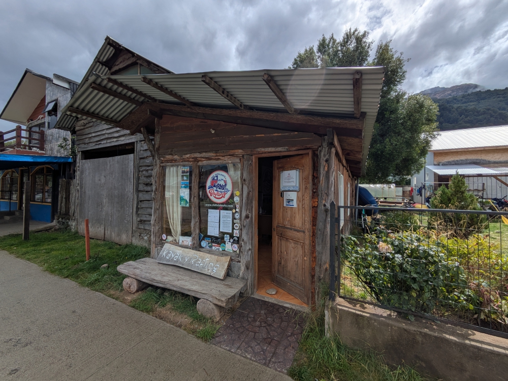
Our rafting company
Next up: Don’t underestimate the white water of the Futaleufú River!
Curious about a previous ten-year chapter in our nomadic lives, which includes eight years aboard a 35-foot sailboat in the tropics with dogs, check out my compelling, inspiring, and refreshingly honest travel memoir:

Discover more from Roaming About
Subscribe to get the latest posts sent to your email.


March 25, 2025 at 2:20 pm
Whew, I’m exhausted just reading about all your gruelling experiences. I think the cold and condensation alone would convince me to give up and head for warmer climes. Throw in the crummy roads, howling winds, and wildly inconsistent “officials” you’ve been dealing with, and it sounds a lot like misery to me. I hope things get better for you soon!
March 29, 2025 at 12:46 pm
Hi Diane,
This certainly isn’t the life for people who like their comfort, convenience, and familiarity, things we are starting to crave as well!! But, we are down here to see and experience beautiful locations, enjoy ourselves, and immerse ourselves in local cultures. Although the fun part has been missing for a while and we are getting sick of looking at and working around the weather. So, soon, we will do just that, head north to warmer weather. And then there will be that nagging voice and realization about missing out on incredible sights, now that we are here…
March 25, 2025 at 3:28 pm
I had the exact same reaction as Diane.
I too hope things get better.
Stay healthy, stay safe,
Steve
March 29, 2025 at 12:48 pm
Thanks, Steve. I think a lot of our unhappiness right now has to do with having to run from and deal with the weather. And now, fall is here – the leaves are turning as I were this – and winter is coming. The idea of being in warmer weather is moving towards the front of our minds. We will get there. Literally. 🙂
March 25, 2025 at 4:41 pm
Wow, that was a lot to pack in into a single post. Lots of challenges, a few set-backs… but you got some amazing pictures (those sunset clouds and sea caves are stunning). Stay safe, you two!
March 29, 2025 at 12:50 pm
Hi Janis,
I am actually not a fan of cramming a month’s worth of activities and sights into one post, but I just haven’t had the time to write shorter posts more frequently. Between all the driving and chores and my current jobs, it’s been busy to say the least. When I look back at the photos – and the positive memories that come with those – I realize that we have been seeing some incredible sights. 🙂
March 25, 2025 at 4:45 pm
You have to go through a lot to enjoy seeing guanacos and spotting fuchsia blooms along the way. I’m glad you met up with friends in your travels. Blessings, Mark, Liesbet, and Maya!
March 29, 2025 at 12:51 pm
Thanks, Marian. You are so right, I feel like we deserved those pretty natural sights and attractions after the trouble we go through to experience them, haha. You always open my eyes. No reward comes easy! 🙂
March 25, 2025 at 4:46 pm
Thanks for presenting us this interesting but rather challenging segment. Things will get slightly better as you drive further North but you will also have to deal with the rainy season if head for the Altiplano.
March 29, 2025 at 12:53 pm
Hello Heinz!
I guess we will have to avoid the Altiplano somehow! 🙂 We have plans to get to warmer weather soon, but the problem is that we don’t want to miss out on sights along the way. Although, our options will diminish greatly soon, as snow will make the mountain roads inaccessible.
March 25, 2025 at 6:56 pm
You had papers from Maya all the way down – shame they don’t work going back up. Hope the weather gets better as you proceed north.
March 29, 2025 at 12:55 pm
Hi Alex,
Yeah, Maya’s international paperwork was usually valid for sixty days, but once we’re past that, we need new forms before crossing into the next country. That’s what we were facing in Fatuleufú. Not obtaining a new permit here would mean a totally different route and a bit of a detour. But, spoiler alert, it did work out on the end! 🙂
March 25, 2025 at 7:14 pm
I so enjoy following your journey—thanks! heidi
March 29, 2025 at 12:55 pm
Thanks for checking in – and still following along – Heidi! I hope your book is doing well.
March 25, 2025 at 7:54 pm
Hi, Liesbet – I admire your patience and resilience through the border delays, vehicle challenges, and less-than-ideal camping spots. The Marble Caves, Rio Baker, and Patagonia National Park sound breathtaking, even with the bumps along the way. Thanks for sharing both the highs and the hardships. I look forward to your next update!
March 29, 2025 at 12:58 pm
Hi Donna,
Mark and I have accepted that this journey is a string of ups and downs, just like real life, but a bit more extreme at times. When does a reward ever come easy? So, we go through the motions, the challenges, and the set-backs, and reap the rewards in the form of natural beauty, awe-inspiring moments, and cool experiences.
March 26, 2025 at 10:17 am
So much beauty. I love that your friends easily found your cow truck.
March 29, 2025 at 1:03 pm
We sure stand out with our cow camper, Jacqui. For good or for bad. But Bella does produce smiles from time to time.
March 26, 2025 at 11:34 am
What a great opening. Honest and painful! Patagonia National Park is beautiful. Glad you were able to find a camp spot near the Rio Baker. The photos of the Marble Caves are stunning. Sorry about Maya. Happy birthday Mark!!!! You shared a few times in this post a growing level of frustration with some of the obstacles and situations you three encountered. I must say in the nearly 9 years we have been traveling full-time, there have been such times we have said or thought the same. Are you two finding the frustrations increasing or is it just the area of South America you are in that is causing these thoughts? Just wondering. Thanks for sharing. Jim
March 29, 2025 at 1:12 pm
Hi Jim,
I am sure that you and Carmen can relate to our frustrations and exhaustion, being full-timers yourselves. How did you deal with those moments?
Just like on our boat (but then it was after seven years), I feel like we are nearing the end of this adventure and our tolerance for the challenges and discomfort. You might remember from my book that I “pushed” Mark to stay on the sailboat a year longer than would have been healthy and I don’t want to make that mistake again. There is no need to put our relationship and happiness in jeopardy, because my tolerance level is higher than his and I want to visit the “entire continent,” before we leave it.
I think being in South America is certainly contributing to how we feel, as there is never a break. As a comparison, we traveled overland (in three different campers) throughout the US for six years, without feeling this way. Yes, the lifestyle gets old and tedious at times, but in the US, we somehow always found a solution quickly, whether it was to visit friends and stay at their home for a few days or to drive down to Baja for better weather and a vacation feeling.
Here, it seems like we don’t find any escape. So we keep going and the bucket gets fuller and fuller. Plus, the weather has been pretty crappy and we haven’t been able to escape it (despite it being summer) for five months. And we are working much more than we used to.
So, yes, we are getting a tad fed up of being here, yet there is still a lot to see… A vicious circle. But, we are heading north now to chase better weather. 🙂
March 30, 2025 at 2:47 pm
Liesbet, our solution to the fatigue and frustrations of traveling full-time has been to slow down for a bit of time. To recuperate. We have only traveled 1500 miles since July 2024 and only stayed in 16 different campsites. Much less than the previous 8 years. Any we are trying to stay in one place longer, sometimes 30 days, and once 90 days. We still want to travel, but we just need to slow down for awhile. Jim
April 2, 2025 at 4:57 pm
Slowing down is the best remedy for travel exhaustion, Jim. Or quitting. But that’s not an option for you two or for us! Breaks from the road are necessary to keep our lifestyles going. We just recently realized that most full-timers or long-timers here in South America fly back to their home countries every summer. What a concept! Not so easy when you’re on a budget and have a dog, though…
March 28, 2025 at 4:51 pm
My take was Wow – what a beautiful string of days and scenery! Hope they outweighed the frustrations. Very cool (and sad) to see Doug Tompkins’s park; his death was such a shock when it happened, and I’m glad his wife Kris maintained a commitment to get things done there.
March 29, 2025 at 1:18 pm
Hi Lexie,
Mark read a biography over Doug Tompkins, which increased my fascination with him and his efforts. I’m super happy too that his wife is still continuing their conservation ideals and goals. I think Patagonia NP actually became a national park a couple of years after he died. Their organization and the ones affiliated with it have made such a difference in Chile and – to some extent – in Argentina. It wasn’t always easy, though.
As far as the challenges and the rewards on our own journey, I still think the pros outweigh the cons, but I might have to reconsider our motto of preferring slow travel to a faster pace through third-world countries. Of course, because this is our life and we have to work every day, a traveling faster is physically, mentally, and logistically impossible.
March 28, 2025 at 9:05 pm
The guanacos are amazing! Everything is so beautiful. I want to go! But I need to figure out when it will be warm. No icy swimming for me.
Glad Mark had a nice birthday dinner and that he didn’t blow the breathalyzer at 11 in the morning.
And the Marble Caves are spectacular. I will have to put that on my to-do list. I love a cave you can float through!
March 29, 2025 at 1:22 pm
Hi Duwan,
Yes, it sure is beautiful down here, especially in the Andes Mountains. We’ve been seeing a lot of different birds as well and the hawks are omnipresent everywhere.
I had to smile at your comment about wanting to do the Carretera Austral and Patagonia when it’s warm. That would be the summer. Which is when we were there. 🙂
That being said, the beginning of this past summer seemed to be warmer than the end of it, so a better approach for us might have been to start on the west side of the continent and return – fast – on the more boring eastern side. Most overlanders go down and up the same way, through the mountains, which has some merit but makes you miss the penguin colonies along Argentina’s coast.
April 1, 2025 at 5:00 pm
Wow, that was some experiences! I enjoy your mini tours of places I’ve never seen or heard of. I’d never heard of a guanaco before either. And I was shocked you were held back so long with papers to enter Chile because they had to check you out with Interpol? Wow! <3
April 3, 2025 at 1:17 pm
Hi Debby,
As you know and can guess, there are so many stories to share about our South American travels and adventures. I’m only picking those I can remember or that left an impact. And while we go slow, compared to most tourists, we still have to skip many areas and sometimes it feels like we don’t have enough time.
I didn’t know what a guanaco was until I heard the term from other overlanders who traveled through Patagonia before us. North of there, you only see llamas, alpacas, and vicuñas (the guanaco look alike, but with a more northern habitat).
April 2, 2025 at 6:05 am
How wonderful that Thirty Bella was recognised from Facebook, Liesbet. That’s the advantage of having such a unique vehicle.
Sounds like there is a lot of rain in the southern part of South America. Knowing it was summer when you had this trip, seeing pictures of you guys wrapped up and under covers inside Thirty Bella is strange. How did you cope with typing with such cold fingers? My fingers never work when it’s too cold.
The marble caves look amazing. That’s a trip I would have liked to have taken. Shame about the captain of the ship saying that Maya was not welcome, though.
I still can not get over the talk of human waste and toilet paper in such a beautiful part of the world. Enough said about that.
April 3, 2025 at 1:28 pm
Hi Hugh,
I remember when a few years ago, someone frowned at the idea of us attaching cow spots to our camper, saying that we would stand out too much. Our answer: this kind of American camper would stand out in South America regardless… 🙂 But, yes, we’ve been recognized more than once, because there’s only one Thirsty Bella!
It was the coldest, wettest, and windiest summer we ever experienced and that was not fun. Never to be repeated. We have a heater, but when we had issues filling our propane tank, we had to be careful turning the heater on. Luckily, it was never too cold to type. Except for a couple of times, when I would hold my hands under the sleeping bag once in a while, to warm them up between typing.
We were so happy and relieved Maya was allowed to join us on that Marble Caves trip, so to be told off at the time of departure was disappointing and annoying. We almost cancelled that ride altogether and postponed it to the next day, when there might be a smaller boat and a friendlier captain.
People in Latin America (and other third-world countries) must not be educated about litter, toilet paper, and waste in nature. Or they’re lazy. They are certainly not thinking straight or realizing how their behavior affect the next visitors. It’s disrespectful and gross!